地すべり研究に関係の深い、地すべり等防止法は昭和33年に成立した。昭和36年には、宅地造成等の規制に関する法律(旧宅造法)が成立している。これらの法整備は、昭和30年代半ばから顕著になった、地方から大都市への人口移動という戦後社会の大きな変動(高度経済成長)に対応した施策であり、出口(中山間地)と入口(大都市)の環境整備を円滑に実施するための制度設計に他ならなかった。すなわち、わが国における地すべりの組織的な調査・研究・対策は、戦後社会がもたらした中山間地の過疎対策としての側面を色濃く有していたことは否めない。同様に、わが国初の地すべり研究拠点として昭和34年に設立された「地すべり研究部門」(当センターの前身)にも、設立の理念において高度成長を支える研究体制の一環としての歴史的意義を見いだすことができる。
地すべり研究部門は、地すべり・斜面崩壊等の斜面災害の発生機構、その災害の形態及び災害防止対策を研究することを目的としていた。実施した主な研究課題は、1)地すべりの発生機構の解明、2)地すべりの予知・予測の研究、3)地すべり地の移動量計測法と地下水調査法の開発、4)地すべりの安定解析、防止工法の効果判定法の研究であった。
平成8年改組以前、防災研究所における“土”に関連した研究組織として、地盤災害研究部門、地形土じょう災害研究部門、地すべり研究部門の3研究部門が設置されていた。平成8年には、“土”関連の上記3部門に傾斜地保全研究分野を加えて、4分野からなる1大部門として改組された。そのうち、地すべりダイナミクス研究分野が、旧地すべり研究部門の定員の大半と研究課題を継承した。
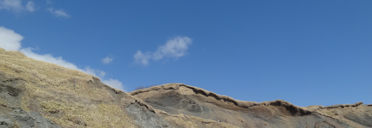
地すべり部門は平成8年の改組で地盤災害研究部門地すべりダイナミクス分野となり、その後、地すべりダイナミクス研究分野と旧災害観測実験研究センターの徳島地すべり観測所を母体として、地すべりダイナミクスと地すべり計測の2研究領域からなる斜面災害研究センターが平成15年(2003)に発足した。設立の目的は、「地すべりによる斜面災害から人命、財産や文化・自然遺産を守るために、地震・豪雨時の地すべり発生運動機構の解明、地球規模での斜面災害の監視システムの開発、地すべりのフィールドにおける現地調査・計測技術の開発及び斜面災害軽減のための教育・能力開発を実施する」ことにある。当センターは、わが国の大学に設置された唯一の斜面災害専門の研究ユニットである。世界的に見てもユニークな組織で、大学における斜面災害研究ユニットとしては、最も古く、かつ最大規模である。
斜面災害研究センターは令和5年に斜面未災学研究センターに改組された。その際に1研究領域が拡張され、当センターは未災情報・斜面災害予測・斜面モニタリングの3研究領域で構成される。
斜面未災学研究センターは下記の3領域から構成されています。所属するメンバーについては、こちらをご覧ください。
Research Center for Landslide Disaster Risk Cognition and Reduction consists of the
following three research fields.
The members in the center are listed here.
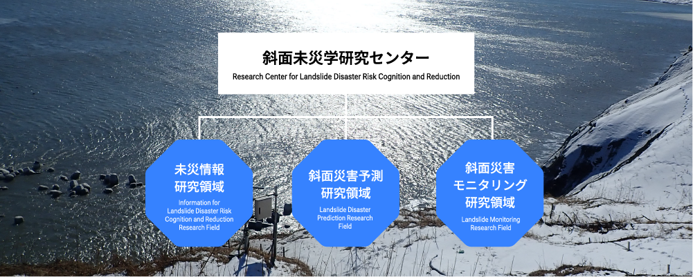
Landslide Monitoring Research Field
当センター前身の斜面災害研究センターのパンフレット(2022 年度版)を下記よりダウンロードできます。
The latest pamphlet can be downloaded from the following link.